Finding the secret base off the Tamami Road.
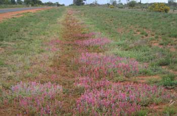
 Some of the wildflowers along the roadside.
Thursday, 12th September, 2010
It's still wet, miserable and overcast, but this afternoon we went for a drive north of the city and out the Tanami Highway. I had heard that there was a secret government base out there somewhere, so I thought it was worth a look.
All the rain had bought out a lot of wildflowers. The further we got from Alice, the more flowers there were.
Once we turned onto the Tanami Road there was a large, out of place, power line along the northern side of the road, and the road itself was in very good condition, so I knew there really was something out there.
Suddenly the power line stopped, and you could see the cables going underground. We had to be close. A little further on the "no entry" signs started on the northern side of the road. Eventually, there was a sealed entrance road with extreme warning signs so we did not venture in.
All that could be seen from the road was the top of a radio tower with a grid-pac style of dish aerial pointing in the direction of Alice Springs.
Disappointed at not seeing more, we turned back for home.
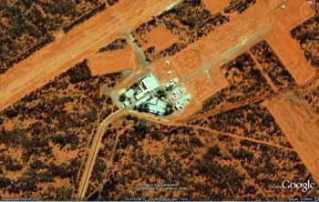
Knowing the area now, I searched on Google Earth and found a 2005 aerial view of the secret site.
 Google Earth image of secret base.
There was a very long airstrip and and a cluster of buildings in the main area. In one corner of the block was a smaller airstrip with couple of smaller buildings.
It was hard to be sure of the exact use of the buildings, but the way they were built right at the airstrip, and their size, made it a possibility that they were/are one of the 'rendition' torture sites for American prisoners.
If you want to check it out yourself, then the coordinates are (23 31 22S, 133 40 48E).

 ©2007, 2008, 2009, 2010 Australian RV |